 Copa Airlines Route Map
Copa Airlines is the flag carrier of Panama, founded in 1947 and a Star Alliance member since 2012. It flies an all Boeing 737 fleet from a single hub, Tocumen International Airport in Panama City, which it calls the Hub of the Americas.
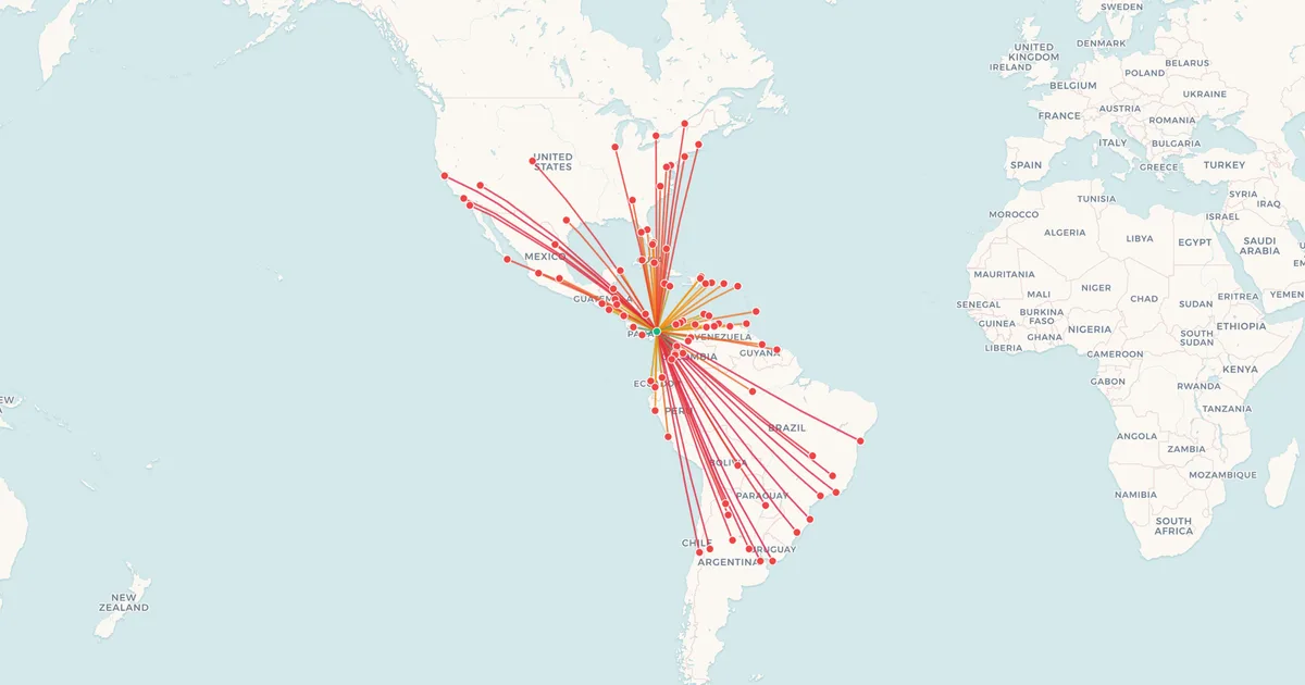
Panama sits between the two halves of the continent, and Copa's network is built on that: flights from across North America, the Caribbean and South America arrive in waves and leave again within the hour, so a trip between two cities that have no nonstop of their own is one short connection in Panama.
Below is the network on a map, every destination with its distance from Panama City, and the longest and shortest routes Copa flies.
At a Glance
- Destinations
- 88
- Countries
- 32
- Hub
- PTY
- Longest route
- Panama City → Montevideo5,466 km (3,396 mi)
- Shortest route
- Panama City → David344 km (214 mi)
PTY: Tocumen International Airport.
Domestic Routes (1)
| Route | Distance | Prices |
|---|---|---|
| Panama City PTY → David DAV | 344 km (214 mi) | See on mapMapI've flown thisFlownCheck prices |
North America and the Caribbean (46)
| Route | Distance | Prices |
|---|---|---|
Panama City PTY → Aruba AUA Aruba | 1,092 km (679 mi) | See on mapMapI've flown thisFlownCheck prices |
Panama City PTY → Atlanta ATL United States | 2,780 km (1,727 mi) | See on mapMapI've flown thisFlownCheck prices |
| Panama City PTY → Austin AUSUnited States | 3,020 km (1,877 mi) | See on mapMapI've flown thisFlownCheck prices |
| Panama City PTY → Baltimore BWIUnited States | 3,358 km (2,087 mi) | See on mapMapI've flown thisFlownCheck prices |
Panama City PTY → Belize City BZE Belize | 1,348 km (838 mi) | See on mapMapI've flown thisFlownCheck prices |
| Panama City PTY → Boston BOSUnited States | 3,791 km (2,356 mi) | See on mapMapI've flown thisFlownCheck prices |
Panama City PTY → Bridgetown BGI Barbados | 2,215 km (1,376 mi) | See on mapMapI've flown thisFlownCheck prices |
Panama City PTY → Cancún CUN MexicoFlights from CUN | 1,554 km (966 mi) | See on mapMapI've flown thisFlownCheck prices |
| Panama City PTY → Chicago ORDUnited States | 3,753 km (2,332 mi) | See on mapMapI've flown thisFlownCheck prices |
| Panama City PTY → Curaçao CUR | 1,191 km (740 mi) | See on mapMapI've flown thisFlownCheck prices |
| Panama City PTY → Denver DEN | 4,242 km (2,636 mi) | |
| Panama City PTY → Fort Lauderdale FLL | 1,892 km (1,176 mi) | |
| Panama City PTY → Guadalajara GDL | 2,864 km (1,780 mi) | |
| Panama City PTY → Guatemala City GUA | 1,358 km (844 mi) | |
| Panama City PTY → Havana HAV | 1,581 km (982 mi) | |
| Panama City PTY → Kingston KIN | 1,025 km (637 mi) | |
| Panama City PTY → Las Vegas LAS | 4,696 km (2,918 mi) | |
| Panama City PTY → Los Angeles LAX | 4,845 km (3,011 mi) | |
| Panama City PTY → Managua MGA | 816 km (507 mi) | |
| Panama City PTY → Mexico City MEX | 2,411 km (1,498 mi) | |
| Panama City PTY → Miami MIA | 1,862 km (1,157 mi) | |
| Panama City PTY → Montego Bay MBJ | 1,061 km (659 mi) | |
| Panama City PTY → Monterrey MTY | 2,870 km (1,783 mi) | |
| Panama City PTY → Montreal YUL | 4,083 km (2,537 mi) | |
| Panama City PTY → Nassau NAS | 1,787 km (1,110 mi) | |
| Panama City PTY → New York JFK | 3,554 km (2,208 mi) | |
| Panama City PTY → Orlando MCO | 2,162 km (1,343 mi) | |
| Panama City PTY → Port of Spain POS | 1,984 km (1,233 mi) | |
| Panama City PTY → Puerto Plata POP | 1,520 km (944 mi) | |
| Panama City PTY → Punta Cana PUJ | 1,590 km (988 mi) | |
| Panama City PTY → Raleigh/Durham RDU | 2,981 km (1,852 mi) | |
| Panama City PTY → San Diego SAN | 4,685 km (2,911 mi) | |
| Panama City PTY → San Francisco SFO | 5,344 km (3,321 mi) | |
| Panama City PTY → San José SJO | 539 km (335 mi) | |
| Panama City PTY → San José del Cabo SJD | 3,587 km (2,229 mi) | |
| Panama City PTY → San Juan SJU | 1,780 km (1,106 mi) | |
| Panama City PTY → San Pedro Sula SAP | 1,168 km (726 mi) | |
| Panama City PTY → San Salvador SAL | 1,161 km (721 mi) | |
| Panama City PTY → Santa Clara SNU | 1,494 km (928 mi) | |
| Panama City PTY → Santiago de los Caballeros STI | 1,488 km (925 mi) | |
| Panama City PTY → Santo Domingo SDQ | 1,477 km (918 mi) | |
| Panama City PTY → St. Maarten SXM | 2,020 km (1,255 mi) | |
| Panama City PTY → Tampa TPA | 2,128 km (1,322 mi) | |
| Panama City PTY → Tegucigalpa XPL | 1,074 km (667 mi) | |
| Panama City PTY → Toronto YYZ | 3,848 km (2,391 mi) | |
| Panama City PTY → Washington IAD | 3,327 km (2,067 mi) |
South America (41)
| Route | Distance | Prices |
|---|---|---|
Panama City PTY → Armenia AXM Colombia | 651 km (405 mi) | See on mapMapI've flown thisFlownCheck prices |
Panama City PTY → Asunción ASU Paraguay | 4,490 km (2,790 mi) | See on mapMapI've flown thisFlownCheck prices |
Panama City PTY → Barcelona (Venezuela) BLA Venezuela | 1,615 km (1,004 mi) | See on mapMapI've flown thisFlownCheck prices |
| Panama City PTY → Barquisimeto BRMVenezuela | 1,104 km (686 mi) | See on mapMapI've flown thisFlownCheck prices |
| Panama City PTY → Barranquilla BAQColombia | 543 km (337 mi) | See on mapMapI've flown thisFlownCheck prices |
Panama City PTY → Belo Horizonte CNF Brazil | 5,022 km (3,121 mi) | See on mapMapI've flown thisFlownCheck prices |
| Panama City PTY → Bogotá BOGColombiaFlights from BOG | 755 km (469 mi) | See on mapMapI've flown thisFlownCheck prices |
| Panama City PTY → Brasília BSBBrazil | 4,437 km (2,757 mi) | See on mapMapI've flown thisFlownCheck prices |
| Panama City PTY → Bucaramanga BGAColombia | 716 km (445 mi) | See on mapMapI've flown thisFlownCheck prices |
Panama City PTY → Buenos Aires EZE ArgentinaFlights from EZE | 5,351 km (3,325 mi) | See on mapMapI've flown thisFlownCheck prices |
| Panama City PTY → Cali CLO | 698 km (434 mi) | |
| Panama City PTY → Caracas CCS | 1,368 km (850 mi) | |
| Panama City PTY → Cartagena CTG | 451 km (280 mi) | |
| Panama City PTY → Chiclayo CIX | 1,764 km (1,096 mi) | |
| Panama City PTY → Córdoba COR | 4,774 km (2,966 mi) | |
| Panama City PTY → Cúcuta CUC | 766 km (476 mi) | |
| Panama City PTY → Florianópolis FLN | 5,263 km (3,270 mi) | |
| Panama City PTY → Georgetown GEO | 2,345 km (1,457 mi) | |
| Panama City PTY → Guayaquil GYE | 1,250 km (777 mi) | |
| Panama City PTY → Lima LIM | 2,359 km (1,466 mi) | |
| Panama City PTY → Manaus MAO | 2,531 km (1,573 mi) | |
| Panama City PTY → Manta MEC | 1,123 km (698 mi) | |
| Panama City PTY → Maracaibo MAR | 855 km (531 mi) | |
| Panama City PTY → Medellín MDE | 543 km (337 mi) | |
| Panama City PTY → Mendoza MDZ | 4,793 km (2,978 mi) | |
| Panama City PTY → Montevideo MVD | 5,466 km (3,396 mi) | |
| Panama City PTY → Paramaribo PBM | 2,698 km (1,676 mi) | |
| Panama City PTY → Pereira PEI | 621 km (386 mi) | |
| Panama City PTY → Porto Alegre POA | 5,288 km (3,286 mi) | |
| Panama City PTY → Quito UIO | 1,029 km (639 mi) | |
| Panama City PTY → Rio de Janeiro GIG | 5,295 km (3,290 mi) | |
| Panama City PTY → Rosario ROS | 5,066 km (3,148 mi) | |
| Panama City PTY → Salta SLA | 4,062 km (2,524 mi) | |
| Panama City PTY → Salvador SSA | 5,151 km (3,201 mi) | |
| Panama City PTY → San Andrés ADZ | 466 km (290 mi) | |
| Panama City PTY → Santa Cruz de la Sierra VVI | 3,466 km (2,154 mi) | |
| Panama City PTY → Santa Marta SMR | 608 km (378 mi) | |
| Panama City PTY → Santiago de Chile SCL | 4,809 km (2,988 mi) | |
| Panama City PTY → São Paulo GRU | 5,086 km (3,160 mi) | |
| Panama City PTY → Tucumán TUC | 4,280 km (2,659 mi) | |
| Panama City PTY → Valencia VLN | 1,262 km (784 mi) |
Network as of September 2026, compiled by My Flight Routes. Schedules change and seasonal routes come and go, so check with the airline before you book.
Related Articles
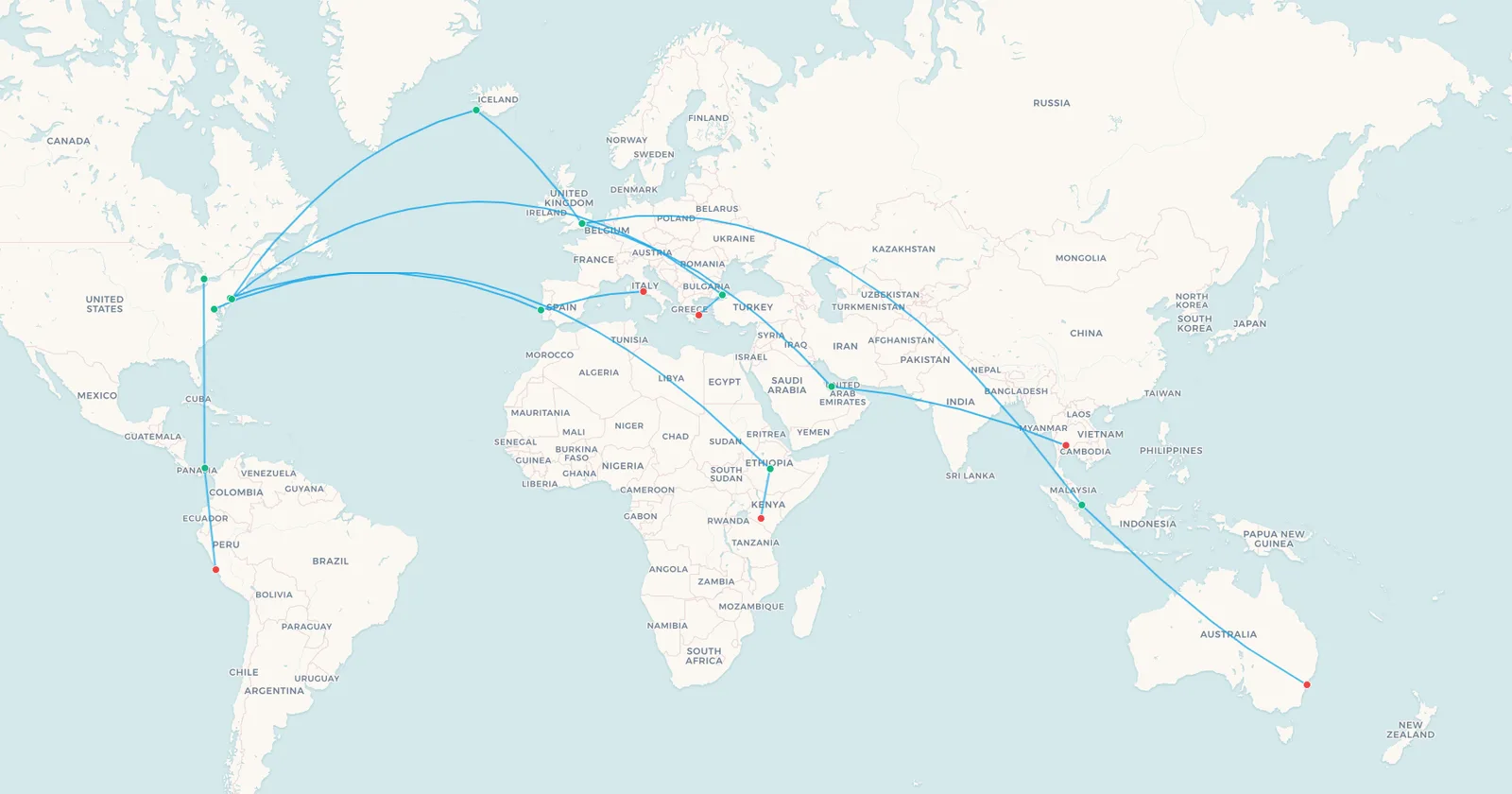

Flown Copa Airlines? Put every flight you have taken on your own map.
Map My Flights